Big Bend National Park: "WOW.. WOW.. WOW! "
Big Bend is magical, haunting, captivating, vast, desolate, beautiful, broken, fascinating, memorable and extraordinary. We felt as if we had been dropped onto a whole new planet.


This was the first truly "WOW!" moment of our journey making all the planning and preparation (including the sale of our house and possessions, buying an RV, moving our daughter to North Carolina, and all the white-knuckling driving it took to get here) worth it all!

BUT FIRST: LEAVING SEMINOLE CANYON:

We always set a goal for departing our campsites no later than 11:00am. This allows enough time to drink our morning coffee and complete all tear-down chores in a leisurely (and careful) manner. Using an amazing website named RV Trip Wizard, we choose each campground based on a 3-4 hour driving radius. Given the stress involved in towing a 13,000 lb trailer, this makes things more manageable. We don't often stop once we're on the road but today we decided to make an exception for this attraction:
TEXAS' TALLEST BRIDGE:

Yep. The Pecos River Bridge is the tallest bridge in the state of Texas and they've even built a rest area so you can stop and take it all in. From this vantage point, you get a really nice view of the river and the bridge that spans it.


The Pecos River used to be known as "the barrier" by westward traveling pioneers. Back in the day, it was almost impossible to forge without the use of a ferry, and even then the transit was dangerous because of the river's swift currents. The first bridge to span this gorge was built in the 1920's but after numerous washouts, the state built this much taller and sturdier structure. The bridge is 1,310 feet long and 273 feet above the water (a measurement which fluctuates with the rise and fall of nearby Lake Amistad).
If you have the time its worth stopping to stretch your legs and get an eyeful of one of nature's barriers and mankind's ingenuity.

You'll notice from the map I placed at the top of this post, there is a whole lot of nothing between Seminole Canyon and our next stop. It was very strange to drive for thirty or forty minutes at a stretch and not see or pass another vehicle. We had the whole, flat, barren desert to ourselves (although funny thing, we came upon a motorist that was being ticketed by a police officer. Not sure how stupid you have to be to not see a police car when visibility has to be fifty miles in both directions).
Another disconcerting thing about this stretch of road is that there is NO cell service for most of the three-hour trip. It is a very odd feeling to be out of communication with the outside world. That's why in my mind's eye, I suddenly saw every conceivable roadside disaster happening to us --simultaneously-- with no help in sight! On second thought, purchasing a satellite phone might not have been such a bad idea.

ONTO OUR CAMPGROUND:

At the intersection of 90 and 385, is the small town of Marathon. Not much to look at but the last location with decent cell service between here and Big Bend.

This last stretch of road was some of the most desolate driving we've done to date. This two lane road, had no shoulder and no pull offs. And again, no cell service. If you break down out here you better be prepared to sit-a-spell because help will not be quickly coming!

Forty-five miles of scrub brush, tumble weeds and cacti. Maybe it was brought on by the stress involved in moving from one campground to another, but I saw Lorraine looking at me askance and commenting, "Boy, you could hide a body out here and nobody would ever find it!"
There are two small campgrounds inside the park. The first is Chisos Basin Campground which has a length restriction prohibiting "trailers over 20 feet and RV's over 24 feet are not recommended due to the narrow, winding road to the Basin and small campsites", and the Rio Grande Village RV Campground which can accommodate 40' RVs, but it only 25 FHU sites and they are booked months in advance. So plan accordingly. We decided to stay in a private campground just outside the park entrance.
I don't know if things have changed since we visited here in February of 2019, but this place is rustic.

REALLY RUSTIC:


REALLY, REALLY RUSTIC!

I just had to post this description from their webpage:
...................................................
"Stillwell's Store and RV Park is located just north of Big Bend National Park, about 8 miles from the Persimmon Gap entrance. ****NOT LOCATED IN ANY TOWN, WE ARE 45 MILES SOUTH OF MARATHON**** The old-fashioned general store carries soft drinks, beer, ice, canned goods and regular gasoline. Our RV park features sites with full 30/50 amp hook-ups (electric, water and sewer), water and electric only sites, dry sites and tent sites. Stillwell is a practical campground with a lot of history, not a resort. Come enjoy the peace and quiet at Stillwell while exploring the nearby Big Bend National Park and Black Gap Wildlife Management Area. Given our ideal location, this is the perfect spot for stargazers, bird watchers and those just wanting to unplug for a bit. Whether it's for a short and or long-term stay, we hope to see you soon!
We stop accepting same-day reservations at 4 p.m.
We do have limited WiFi at the store. The nearest cell phone service is about 15 miles away in BBNP.
If technology is your top concern, this likely isn't the place for you. "
...................................................
Truer words were never written! Overall, we enjoyed our stay at this park because of its location. If you have a choice, get a spot near the office because they had great wifi. Even in this desert (and deserted) location, we were able to stream movies!

"OH NO!!"
This also brings us to our first "Oh X@&$" moment...
After pulling into our site, I began pulling the usual hoses and cables from the bottom of our basement. As I was laying these items on the ground, I noticed something whitish-gray sticking to the bottom of one of our tires. At first glance, I thought it was a piece of old newspaper, but at second glance brought a cold chill down my spine. To my horror I realized I was looking directly at the steel belts of the tire! A giant chunk of the tread had torn away!

How long we were riding on it is hard to say, but we were grateful that it didn't blow and rip out the underside of our RV (as has happened to so many RVers). We considered ourselves very blessed.
If you've followed our blog, you might remember me writing about this incident in a former post. It was quite an ordeal to get new tires especially in a section of the country where towns (and cell towers) are few and far between, but if you'd like to read the post of our ordeal, click here.

ON TO BIG BEND NATIONAL PARK!
We had heard so much about this National park from other RVers that our expectations were set pretty high. And it did not disappoint.
[Sidenote: Many people told us it was the "largest and least visited" park in the National Park system, but we found out later that that honor actually goes to Alaska's Wrangell-St.Elias National Park. ]
As far as beauty is concerned, this is the big leagues.

And I must admit, as we approached our first set of colorful rocky plateaus, I immediately understood why so many western artists have drawn their inspiration from these parts.

The park is 1,252 square miles (801k acres) of barren, unspoiled, apocalyptic allure.
Spending the majority of our lives in the Northeast, where there is plenty of greenery and a few gently rolling hills, this was a whole new world.

Keep in mind that Big Bend is huge! It took us almost 40 minutes to travel from our campground to the Chisos Basin Visitor Center at the middle of the park! And there is not a straight road anywhere to be found. Give yourself plenty of extra time because of the distance between attractions.

Sadly, we were only spending 4 nights here. We had drastically under estimated how much time we would need to see the entire park. The NPS publishes an interesting guide with suggestions on what to see based on the number of days you are staying. Click here if you want to read it.
From the moment we drove in to the moment we left, we never stopped being amazed at the beauty of the desert.
If you want to see a close-up of the park map, click here.
The park has 102 different trails stretching for 333 miles.
35 - Are rated "Easy"
54 - Are rated "Intermediate"
13 - Are rated "Difficult"
These are the trails we hiked:
BALANCED ROCK TRAIL:
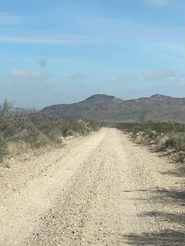
This was the first hike we did and we loved it. It’s short and relatively easy and winds its way through some beautiful scenery. To get here, you drive 6.5 miles on a dirt/gravel road complete with ruts, holes and bumps. This takes you the Grapevine Hills Trail. From here it's about a two mile hike to Balanced Rock. There are a few rock scrambles that you need to climb over/around so wear good hiking shoes/boots.

Click on the left or right arrows to scroll through the pictures
SAM NAIL RANCH TRAIL:
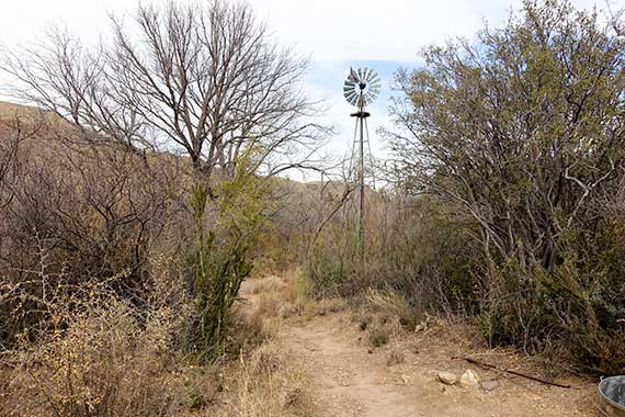
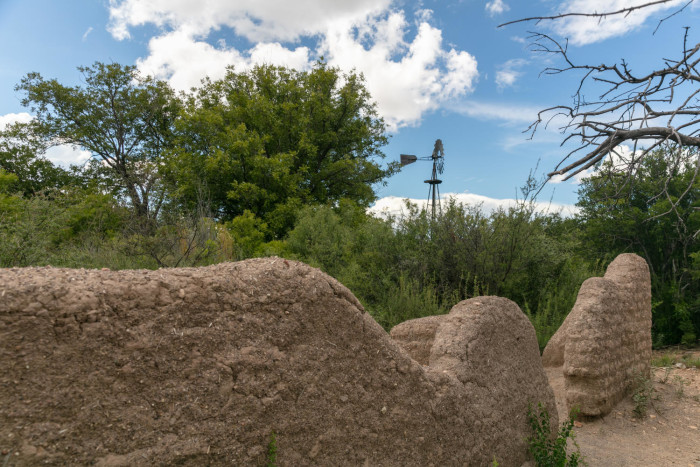
This short trail (about half a mile) takes you to the site of the former ranch of the Nail brothers (Jim and Sam). They settled here in the early 1900's to raise horses and cattle. They even planted non-native fruit trees (pecan and fig) that still produce fruit today. As you look at the remains of the adobe walls, broken fence posts, and strands of rusty barbed wire, you get a whiff of what life must have been like back at the turn of the century.
Click on the left or right arrows to scroll through the pictures
It was fascinating to see that the windmill was still pumping water even after almost 100 years. If you ask me, the west wasn't won with the Winchester rifles, it was won by Daniel Halladay, who in 1854, developed the American-type windmill. It was smaller, less expensive and could be shipped and built easily.
There was one other thought that gnawed at me as I walked the property: given the rock-strewn desolation that surrounds this arid area, and its uncanny resemblance to the surface of Mars, what would make some settler back-in-the-day say, "Martha, unhitch the wagon, we've found the place I want to stake my claim!" Different times, I suppose.
If you have an interest in reading a fascinating article about Jim and Sam Nail, click here.

THE WINDOW TRAIL:

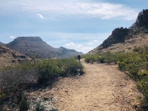
Overall, this was our favorite hike in the park. The 4.4 mile trail starts on the floor of Chisos Basin and follows the upper portion of Oak Creek Canyon leading to the 700-foot Window pour-off which frames a panoramic desert vista. The gradient is gentle and the path is wide and easy to follow. It took us about three hours to make this out-and-back trail. It always amazes us to see twenty-somethings hiking in flip-flops, and although this is a relatively easy hike, hiking boots or shoes are highly recommended.
Click on the left or right arrows to scroll through the pictures
Keep in mind that people have reported seeing black bears, mountain lions, and javelinas along this trail. Sadly my pictures don't do it justice.

HOT SPRINGS!

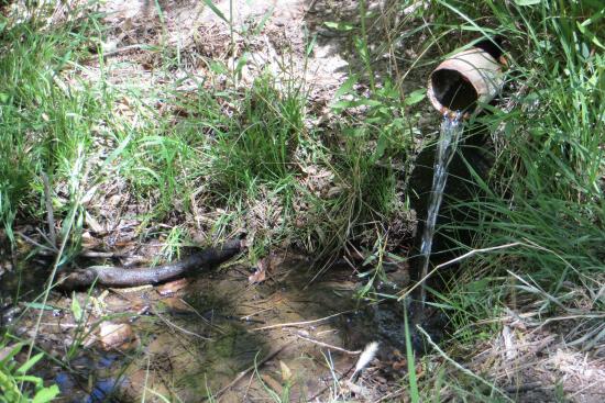
The road to the trail takes you through the park's only tunnel! Once you find the trailhead, it's a short walk to the mineral-rich waters that bubble up from a geothermal spring bordering the Rio Grande. The water is a consistent 105°F. The tall grass on the other side of the river is the country of Mexico! The cement pool you sit in are the remains of the Langford Bathhouse that operated here over 100 years ago. It's a great place to take a relaxing soak. Remember, bathing suits are not optional!
Click on the left or right arrows to scroll through the pictures
BOQUILLAS CANYON TRAIL:

This short, 1.6 miles trail takes you to the edge of the Rio Grande. Along the way you get to enjoy one of the three main canyons in the park. The trail is mostly flat and very scenic. There is one spot where we saw vendors crossing the river from the nearby town of Boquillas, Mexico. At first I thought we were witnessing something illegal but as it turns out, they bring over little trinkets to sell. The park ranger told us that there's an agreement (whether written or unwritten, I do not know) that they can cross but they can't stick around.

SANTA ELENA CANYON

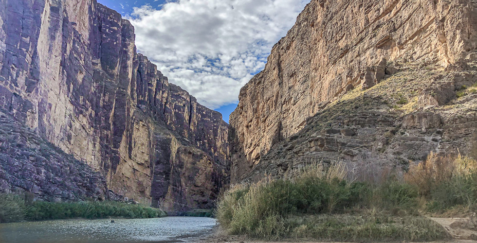
This is one of the best (and most beautiful) hikes in Big Bend National Park. It’s short (1.7 miles), it’s easy, and this is the best up-close experience with the Rio Grande.

Below is a really cool 3-D picture from Fatmap.com of the trail leading from the parking area into the mouth of the canyon. This just gives you some idea of how amazing this hike is.

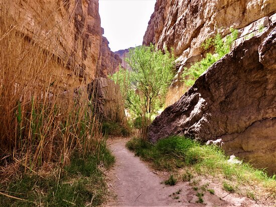
You hike through the canyon along the edge of the river. There are a few rocks you need to step around but it is an easy hike and one you don't want to miss.
Click on the left or right arrows to scroll through the pictures

WRAPPING THINGS UP:
As you can see, we did a lot in the short amount of time we had. There are a few other interesting things I wanted to highlight before wrapping up this post:
First, we received this message on our phones while we were in the park (and on U.S. soil):

It made me chuckle to think that even though we were still on U.S. soil, our cell phones connected to Mexican cell phone towers!
Secondly, we saw this sign in the park:

Given that black bears can run up to 30 miles per hour, advising motorists to slow to 15 mph might be giving the bears an unfair advantage??
Thirdly, if you stay at Stillwell Ranch, visit the small museum on the property. You get the keys from the front office where they'll tell you to turn off the lights when you leave. The museum is a tribute to the life of Hallie Stillwell who managed this ranch by herself for over twenty years. Following the sudden death of her husband, she fought to preserve the ranching lifestyle by giving lectures, running a coffee shop, clerking for the city, and serving as a Justice of the Peace. She was a dynamo and left her mark on this area.

Lastly, each exhausting day concluded with our feet up and a cold drink in our hand. Just the way we like.

Life is good..
See you on down the road!















What a great adventure! I know you were here over 4 yrs ago, but this blog couldn’t be timed better. We’ll be there next week and hope it can stay under 100 degrees long enough so we can do those beautiful hikes you describe!